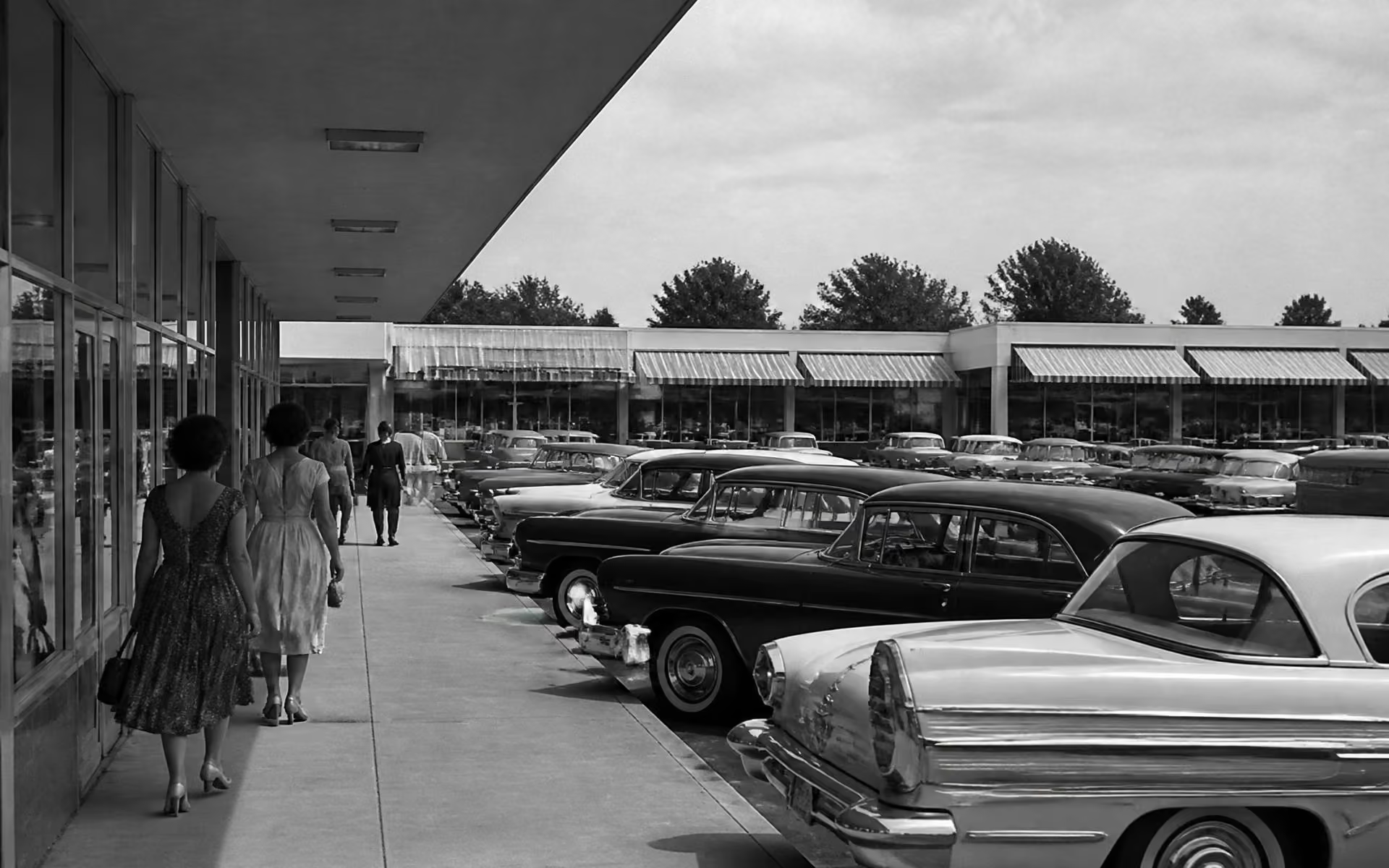
Cotswold's history is Charlotte's history in miniature: a postwar push southeast of the old streetcar suburbs, subdivisions platted quickly on farmland, an English name borrowed for marketing, and a shopping center that turned a collection of plats into a place with an identity.
A timeline of Cotswold
Before 1945
Farmland on the southeastern edge
The land sits outside Charlotte's streetcar suburbs — close enough to be obvious for growth, cheap enough to be practical.
1950s
The plats go down
Developers subdivide the area in separate, independently platted tracts. Brick ranches and split-levels go up on flat, wide lots designed around the car.
1960s
A shopping center gives the area its name
Retail arrives at Randolph Road and Sharon Amity, borrowing an English place name. The name spreads outward to describe everything around it.
1970s–1990s
Maturity, and reinvestment in the center
Canopy fills in, families turn over slowly, and capital keeps returning to the commercial node — sparing Cotswold the decline some comparable first-ring centers saw.
2000s
Redevelopment of the Village
The shopping district is reconfigured with new anchors and outparcels, restoring it as a full-service errand hub for the surrounding streets.
2010s–today
The renovation and rebuild cycle
Rising in-town land value turns Cotswold into one of Charlotte's most active renovation and infill markets. Original ranches, gut remodels, and new custom homes now share the same blocks.
Before the subdivisions
The land that became Cotswold was farmland and woodland on Charlotte's southeastern edge, outside the streetcar-era development that produced Dilworth, Elizabeth, and the first phases of Myers Park. It was close enough to be obvious and far enough to be cheap — the standard precondition for postwar suburban development everywhere in America.
The postwar boom
Charlotte grew hard after the Second World War, and the combination of federal mortgage programs, cheap land, and mass automobile ownership pushed development outward. Developers platted the Cotswold-area subdivisions through the 1950s and 1960s and built the brick ranch and split-level houses that still define the streets — solid, efficient, and aimed at families moving out of older in-town housing.
The English name
Charlotte developers of the era borrowed English place names freely — a marketing convention that produced neighborhood names across the city with no local historical basis whatsoever. Cotswold takes its name from the Cotswolds region of England. The name attached to the shopping center first and then spread outward to describe everything around it, which is why the neighborhood's boundaries have always been a matter of consensus rather than record.
The center as anchor
The shopping center's arrival was the decisive event. It gave the area a name, a center, and a set of conveniences that most postwar Charlotte subdivisions did not have. Crucially, capital kept returning to it through subsequent decades — reconfigurations, replaced anchors, new outparcels — which spared the surrounding streets the decline that hit some comparable first-ring commercial nodes in the 1980s.
The renovation era
From roughly the mid-2000s onward, rising in-town land values and a generational shift in how people wanted to live turned Cotswold into one of Charlotte's most active renovation and infill markets. That cycle is still running, and it is the reason a single block can hold an original 1958 ranch and a 2024 custom home. See architecture for how that reads on the street and real estate for what it means to a buyer.
Researching a specific house
For any individual property, the county's parcel and assessor records carry build year, recorded plat, ownership history, and permit activity. That is the authoritative source — neighborhood lore, including some of what is repeated online about Cotswold, frequently is not. Pull the parcel on POLARIS, then check the chain of title and any recorded covenants through the Register of Deeds.
Where the history is still visible
- Original brick ranch and split-level houses, especially on the interior blocks.
- Wide, flat lots with generous setbacks — a car-era plat, not a streetcar one.
- Mature canopy planted in the first two decades after build-out.
- The commercial node at Randolph and Sharon Amity, still doing the job it was built for.
- Curvilinear street patterns that vary by subdivision, reflecting different developers.
For how that inheritance reads on the street today, see Cotswold architecture; for what the rebuild cycle means to a buyer, Cotswold real estate and home values; and for the enclaves that grew out of those original plats, Cotswold neighborhoods and streets. For the present-day overview, start with our guide to the Cotswold neighborhood in Charlotte.